Identification of the agroclimatic suitability in the municipality of Fusagasuga (Cundinamarca) for pea crop (Pisum sativum L.), using participatory mapping
- Fabio Ernesto Martínez-Maldonado
 ,
, - Douglas Andrés Gómez-Latorre,
- Gustavo Adolfo Araujo-Carrillo,
- Andrea Onelia Rodríguez-Roa,
- Jhon Mauricio Estupiñan-Casallas,
- Leidy Yibeth Deantonio-Florido,
- Martha Marina Bolaños-Benavides
Abstract
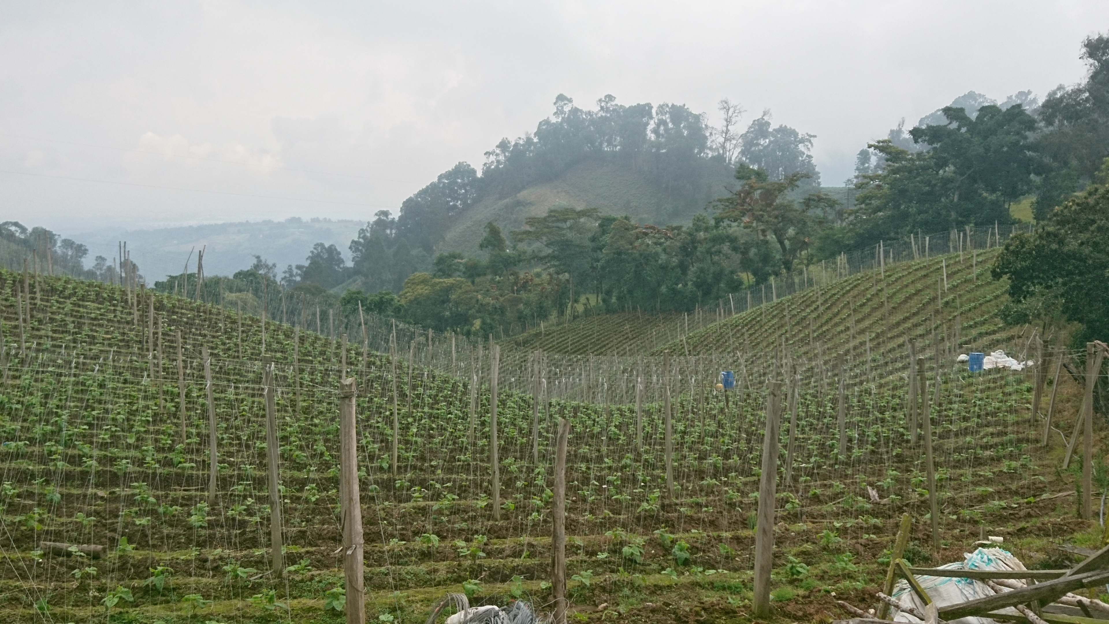
Pea crop is highly vulnerable to the negative impacts of variability and climate change, due to its socioeconomic and environmental marginality, as well as the poor use of technical tools such as agroclimatic information. Therefore, in order to understand the local pea growers perception of agroclimatic risk, a participatory mapping experience implemented in the rural area of the municipality of Fusagasuga was performed. Edaphoclimatic constraints and opportunities of the Municipality for pea crop were identified. The exercise started with the dissemination of local climatic data and thematic cartography related to biophysical variables like elevation and slope. Local descriptions of soil characteristics were defined with the community to identify areas with the most and the least limiting soil conditions for pea crop. In addition, the areas with greater susceptibility to water deficit and water excess were identified. The paper emphasizes on the methodological and pedagogical process generated for the identification of agroclimatic risks. The results show how participatory learning empowers communities with information to improve their own knowledge of the territory. This approach contributes to the adaptative capacity to extreme weather events since it provides elements for community organization to face risk. The participatory approach allowed the identification of Aguadita, Bermejal, Tierranegra, La Palma, Bochica, Batan, Santa Lucía, El Guavio y El Carmen as low-risk areas for pea production due to their soil advantages and low occurrence of water deficit and water excess events.
Keywords
Agroclimatic risk, Climatic variability, Extreme events, Territory, Participatory mapping
Author Biography
Douglas Andrés Gómez-Latorre
Investigador Máster del Centro de Investigación Tibaitatá, Grupo de Agroclimatología
References
- Agronet. 2021. Reporte: área, producción y rendimiento nacional para el cultivo de arveja 2006 - 2019. In: https://www.agronet.gov.co/estadistica/Paginas/home.aspx?cod=1; consulted: July, 2021.
- Agrosavia, Corporación Colombiana de Investigación Agropecuaria. 2013. Modelos de adaptación y prevención agroclimática: opciones tecnológicas frente al cambio climático. Mosquera, Colombia.
- Agrosavia. 2017. Sistema Experto MAPA v 2.0. Proyecto: Modelos de Prevención y Adaptación MAPA. In: Corporación Colombiana de Investigación Agropecuaria (Agrosavia), in: http://www.corpoica.org.co:8086/NetCorpoicaMVC/SEMapa/; consulted: July, 2021.
- Agrosavia and INAT, 1999. Manejo de cultivos bajo riego en distritos de pequeña escala. Manual de Asistencia Técnica No. 5. Bogota.
- Alberich, T. 2007. Investigación acción participativa y mapas sociales. Benlloch, Castellón de la Plana, Spain.
- Bacher-Martínez, C. 2017. Aportes de la investigación-acción participativa a una teología de los signos de los tiempos en América Latina. Theol. Xave. 184, 309-332. Doi: 10.11144/javeriana.tx67-184.aiptst
- Bailey, K.M., M.D. Drake, J. Salerno, L. Cassidy, A.E. Gaughan, F.R. Stevens, N.G. Pricope, K.D. Woodward, H.M. Luwaya, and J. Hartter. 2020. Mapping natural resource collection areas from household survey data in Southern Africa. Appl. Geograp. 125, 102326. Doi: 10.1016/j.apgeog.2020.102326
- Basarab, N. 2013. La necesidad de la transdisciplinariedad en la educación superior. Discurso central del Congreso internacional de educación superior celebrado en Estambul, Turquía. Trans-Pasando Fronteras 3, 23-30. Doi: 10.18046/retf.i3.1624
- Beddington, J., M. Asaduzzaman, A. Fernandez, M. Clark, M. Guillou, M. Jahn, L. Erda T. Mamo, N. VanBo, CA. Nobre, R. Scholes, R. Sharma, and R.J. Wakhungu. 2011. Achieving food security in the face of climate change: Summary for policy makers from the Commission on Sustainable Agriculture and Climate Change. CGIAR Research Program on Climate Change, Agriculture and Food Security (CCAFS). Copenhagen, Denmark.
- Braceras, I. 2012. Cartografía participativa: herramienta de empoderamiento y participación por el derecho al territorio. MSc thesis. Hegoa Instituto de Estudios sobre Desarrollo y Cooperación Internacional. Universidad del País Vasco, San Sebastian, Spain.
- Carvajal, J. 2005. Fortalecimiento de las organizaciones pertenecientes a la asociación de proyectos comunitarios. In: Territorio y cartografía social – Módulo 0. Asociación de Proyectos Comunitarios, Popayan, Colombia.
- CCAFS, CGIAR Research Program on Climate Change, Agriculture and Food Security. 2015. TeSAC: opciones para mejorar la resiliencia y la seguridad alimentaria. Cali, Colombia. In https://hdl.handle.net/10568/68618; consulted: July, 2021.
- Chambers, R. 2006. El mapeo participativo y los sistemas de información geográfica: ¿De quién son los mapas? ¿Quién se empodera y quién se desempodera? ¿Quién gana y quién pierde?. Elect. J. Infor. Syst. Dev. Countr. 25(2), 1-14.
- Colmenares, A.M. 2012. Investigación-acción participativa: una metodología integradora del conocimiento y la acción. Voces Silenc. Rev. Latinoam. Educ. 3(1), 102-115. Doi: 10.18175/vys3.1.2012.07
- De Sousa-Santos, B. 1991. Una cartografía simbólica de las representaciones sociales Prolegómenos a una concepción posmoderna del derecho. Nueva Soc. 116, 18-38.
- Fals Borda, O. 1999. Orígenes universales y retos actuales de la IAP (Investigación Acción Participativa). Anal. Político 38, 71-88.
- Fenalce, Federación Nacional de Cultivadores de Cereales y Leguminosas of Colombia. 2006. El cultivo de la arveja. Historia e importancia. El Cerealista 93, 32-35.
- Fenalce, Federación Nacional de Cultivadores de Cereales y Leguminosas of Colombia. 2017. Reportes estadísticos de área, producción y rendimiento cereales y leguminosas 2017. In: http://www.fenalce.org/alfa/dat_particular/ar/ar_18452_q_APR_2017_B.pdf; consulted: July, 2021.
- FIDA, Fondo Internacional de Desarrollo Agrícola. 2010. El enfoque adaptativo del FIDA relativo a la Cartografía Participativa; diseño y ejecución de proyectos de Cartografía Participativa. Rome.
- Foucault, M. 1988. El sujeto y el poder. Rev. Mex. Sociol. 50(3), 3-20. Doi: 10.2307/3540551
- Gonzalez, F. and G. Ligarreto. 2006. Rendimiento de ocho genotipos promisorios de arveja arbustiva (Pisum sativum L.) bajo sistema de agricultura protegida. Fitotec. Colomb. 6(2), 52-6.
- Herlihy, P.H. and G. Knapp. 2003. Maps of, by, and for the peoples of Latin America. Human Organization. J. Soc. Appl. Anthropol. 62(4), 303-313. Doi: 10.17730/humo.62.4.8763apjq8u053p03
- Herlihy, P.H. and T.A. Tappan. 2019. Recognizing indigenous Miskitu territory in Honduras. Geogr. Rev. 109(1), 67-86. Doi: 10.1111/gere.12309
- INIA, Agricultural Research Institute. 2015. Producción de leguminosas de invierno. Provincia de Arauco. Cañete, Chile.
- Jimenez Montero, M. 2020. Investigación acción participativa: Un diseño metodológico para la práctica extensionista. Investiga.TEC (39), 14.
- Labrador Moreno, J. 2002. La materia orgánica en los agroecosistemas: aproximación al conocimiento de la dinámica, la gestión y la reutilización de la materia orgánica en los agrosistemas. 2nd ed. Ministerio de Agricultura, Pesca y Alimentación; Mundi-Prensa, Madrid.
- Martín Silva, V.B., M.E. Zabala, and M. Fabra. 2019. Cartografía social como recurso metodológico para el análisis patrimonial. Experiencias de mapeo en Miramar (Córdoba, Argentina). Perspect. Geogr. 24(2), 127-150. Doi: 10.19053/01233769.8631
- Martinez M., F.E. L.Y. Deantonio F., G.A. Araujo C., E.O. Rojas, D.A. Gómez-Latorre, D.F. Alzate, A. Ortiz, L., E. Aguilera G., and J.F. Boshell-Villamarin. 2016. Agroclimatic zoning methodology for agricultural production systems in dry Caribbean region of Colombia. Agron. Colomb. 34(3), 374-384. Doi: 10.15446/agron.colomb.v34n3.59672
- Martínez, L., A. Ysuiza, and O. Altamirano. 2007. Guía metodológica de análisis participativo del riesgo de desastres para áreas rurales. GTZ, Lima.
- McConchie, J.A. and J.M. McKinnon. 2002. Using GIS to produce community based maps to promote collaborative natural resource management. Asean Biodiversity (January-March), 27-34.
- Milagres, C.S.F., J.A.A. Ferreira Neto, and D.N. Sousa. 2020. The power of maps and participatory approaches: the use of social cartography in the territorial representation of rural settlements. Interações 21(2), 273-286. Doi: 10.20435/inter.v21i2.2190
- Ojeda-Trejo, E., J. León, C. Dunn, and L. Cajuste-Bontemps. 2014. Cartografía participativa para el ordenamiento territorial comunitario. El Colegio de Postgraduados, Mexico, DF.
- Omondi, L. A. 2020. Learning together: Participatory rural appraisal for coproduction of climate change knowledge. Action Res. Doi: 10.1177/1476750320905901
- Osorio R., M.L. and A. Contreras. 2009. El diagnóstico rural participativo y el manejo de los recursos naturales. Estud. Agrar. 42, 109-136.
- Román Bermejo, L. 2016. Metodologías participativas para el desarrollo rural. Un enfoque desde la agroecología. PhD thesis. Programa de Doctorado en Agroecología, Universidad Internacional de Andalucía. In: https://core.ac.uk/download/pdf/223061651.pdf; consulted: May, 2021.
- Soares, D. and A. García. 2017. La cuenca del río Usumacinta desde la perspectiva del cambio climático. Instituto Mexicano de Tecnología del Agua, Jiutepec, Mexico.
- Vélez, I., S. Rátiva, and D. Varela. 2012. Cartografía social como metodología participativa y colaborativa de investigación en el territorio afrodescendiente de la cuenca alta del río Cauca. Cuad. Geogr.: Rev. Colomb. Geogr. 21(2), 59-73. Doi: 10.15446/rcdg.v21n2.25774